Tuesday, August 18, 2026
City & Local
Best in CityLocal GuidesBusiness SpotlightsFood & DrinkEvents
City & Local

Your guide to the best of local living.

Local GovernmentNeighborhoodsSmall BusinessCommunityEconomyEntrepreneurshipCommercial InsuranceRisk Management

Sections

  • Best in City
  • Local Guides
  • Business Spotlights
  • Services
  • Food & Drink

More

  • Events
  • Neighborhoods
  • Community
  • Real Estate
  • Writers

About City & Local

City & Local is your premier source for discovering the best that your community has to offer. From local guides and business spotlights to events and real estate, we cover everything that matters to you.

  • Contact
  • Privacy Policy
  • Terms of Service

© 2026 City & Local. All rights reserved.

  1. Home
  2. /Local Guides
  3. /How Evolving City Maps Use Digital Tools to Optimize Urban Planning
Local Guides

How Evolving City Maps Use Digital Tools to Optimize Urban Planning

A city planner in 2026 can now generate a high-fidelity 3D urban scene from a simple text prompt, or design a building that adapts its structure in real-time to environmental changes.

DM
Derek Molina

July 3, 2026 · 4 min read

Futuristic cityscape with holographic data overlays and a dynamic 3D map, illustrating advanced urban planning tools.

A city planner in 2026 can now generate a high-fidelity 3D urban scene from a simple text prompt, or design a building that adapts its structure in real-time to environmental changes. These advanced capabilities rapidly evolve city maps with digital tools and real-time data, offering precision and responsiveness previously unattainable.

Urban development has long been a slow, static process based on fixed plans. But AI and digital twins enable dynamic, real-time adaptation and predictive capabilities. This shift challenges traditional methods, pushing cities towards continuous algorithmic adaptation rather than static blueprints.

Cities that fail to integrate these advanced digital tools risk becoming obsolete. They miss critical real-time insights for resilience and efficiency that competitors will leverage. Those that embrace them will lead the way in creating truly smart, resilient, and responsive urban futures.

The Digital Twin Revolutionizing City Planning

Advanced urban design software now creates digital twins of entire cities. These sophisticated models move planning beyond static blueprints, offering immersive, data-rich environments for analysis and rapid prototyping. Visualizing new urban projects has become highly automated. For example, Tripo AI generates high-fidelity 3D urban scenes, assets, and models from simple prompts or images, according to ArchiVinci. This democratizes high-fidelity visualization, letting non-experts generate complex 3D scenes. ArchiVinci itself uses generative AI to transform sketches or floor plans into photorealistic visuals.

This marks a significant shift. Architizer suggests AI tools help architects explore design possibilities, but ArchiVinci's tools show AI can autonomously generate high-fidelity 3D urban scenes. Generative AI for urban design means the bottleneck is no longer design iteration or visualization. Instead, it's the human capacity to critically evaluate and govern an explosion of algorithmic possibilities.

Building Smarter, More Responsive Urban Ecosystems

AI algorithms now analyze traffic patterns to optimize road networks and predict public utility maintenance needs, according to Architizer. This real-time analysis makes cities proactive, adaptive, and more efficient in daily operations.
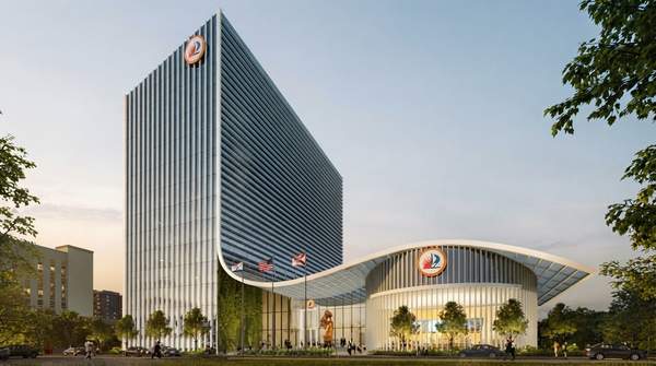
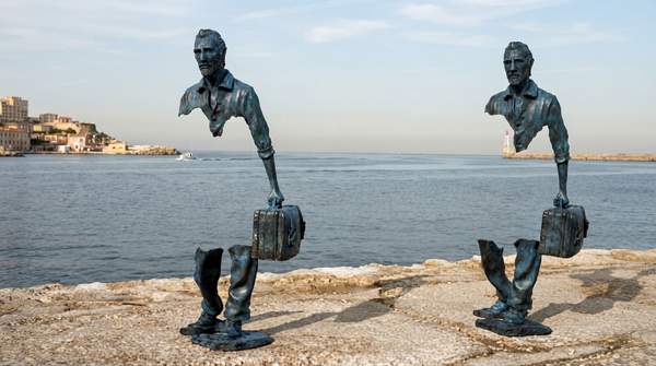
Responsive architecture is another advancement. AI-enabled designs adapt to changing environmental conditions and user preferences in real time. Buildings become dynamic, living structures, not static entities. This transitions urban infrastructure from static assets to dynamic, self-optimizing systems, demanding a fundamental rethink of maintenance cycles and long-term planning. This convergence of predictive AI and responsive architecture creates urban environments that are not just smart, but self-optimizing and self-healing. These systems operate with autonomy beyond constant human intervention, enhancing resilience and reliability across interconnected infrastructure.

Navigating the Challenges of Algorithmic Cities

The rapid shift towards AI-powered urban planning introduces new challenges for city leaders and residents. While the promise of efficiency is high, the transition from established, fixed-plan development to continuous algorithmic adaptation requires careful governance and oversight.

One significant pitfall involves data privacy and security. As digital twins become the operational brains of cities, collecting vast amounts of real-time data, ensuring this information is protected from misuse or cyber threats is paramount. Without robust security protocols, the benefits of smart cities could be undermined by significant vulnerabilities.

Another challenge is the potential for algorithmic bias. If the AI models are trained on incomplete or biased data, they could perpetuate or even amplify existing inequalities within urban environments. This necessitates diverse data inputs and continuous auditing of AI decisions to ensure equitable outcomes for all community members.

Strategies for Future-Proofing Urban Development

To successfully integrate AI and digital twins, cities must prioritize investment in skilled personnel and training programs. Urban planners and administrators need to understand how to interact with these complex systems, interpret AI-generated insights, and make informed decisions.

Establishing clear ethical guidelines for AI deployment in urban settings is also crucial. These guidelines should address issues like data transparency, accountability for AI-driven decisions, and the balance between automation and human oversight. Public engagement in developing these frameworks can foster trust and ensure community values are reflected in technological advancements.

Furthermore, cities should adopt a phased implementation approach, starting with pilot projects in specific sectors like transportation or energy management. Learning from these smaller-scale deployments can help refine strategies and address unforeseen issues before expanding AI integration across the entire urban fabric.

How is real-time data used in smart city mapping?

Real-time data is integrated into smart city mapping by feeding live information from sensors, cameras, and mobile devices into digital twin models. This allows urban planners to monitor traffic flows, air quality, public utility performance, and pedestrian movement instantly. For example, traffic management systems can adjust signal timings in response to current congestion levels, as detailed by Tandfonline in a full article on real-time GIS for smart cities.

What are the benefits of digital city maps?

Digital city maps offer numerous benefits, including enhanced visualization, improved decision-making through data analysis, and the ability to simulate future scenarios. They allow planners to test the impact of new developments or policy changes virtually before implementation. Additionally, these maps facilitate better communication among stakeholders by providing a common, interactive platform for urban planning discussions.

What technologies are used to update city maps in real-time?

Several technologies enable real-time updates for city maps, including Geographic Information Systems (GIS), Internet of Things (IoT) sensors, and satellite imagery. Drone technology and LiDAR scanning also contribute to capturing up-to-date topographical and structural data. These systems continuously feed information into digital models, ensuring maps reflect the most current urban conditions.

The Bottom Line for Urban Futures

If cities do not embrace AI-powered digital twins for real-time adaptation and predictive analytics, they will likely fall behind by Q4 2026, as dynamic urban planning becomes the standard for successful environments.

Related Coverage

  • Local veterans offer community service

Tags

Urban PlanningDigital TwinsAi In City PlanningSmart CitiesGeospatial TechnologyFuture Of CitiesUrban DevelopmentData Driven Planning
DM

Derek Molina

Local Editor

As Local Editor for City & Local, Derek Molina covers neighborhoods, community developments, and local guides. He focuses on delivering insightful community reporting and municipal governance updates to keep residents connected to their local area.

More from Local Guides

Tourists participating in guided walking and cycling tours across various Indian cities, facilitated by a partnership between MakeMyTrip and the Ministry of Tourism.

MakeMyTrip and Ministry of Tourism launch guided tours in India

Starting at just ₹500, Indian travelers can now choose from over 350 government-backed guided tours across 60 cities, thanks to a new partnership between MakeMyTrip and the Ministry of Tourism for 202

Derek Molina· Aug 16
A picturesque Italian landscape featuring Mount Vesuvius, a rustic farmhouse, and a vintage train, symbolizing slow travel and culinary exploration.

Italy's slow travel routes redefine holidays with food and transit

In the volcanic soils of Mount Vesuvius, Casa Barone stands as one of the world's sole producers of Piennolo tomatoes, offering a rare culinary heritage often overlooked by mass tourism.

Derek Molina· Aug 15
Mount Etna erupting with a large ash cloud and lava flows, as tourists watch from a safe distance.

Mount Etna eruption continues, testing tourism resilience

For five consecutive days, ash spewing from Mount Etna forced Catania's airport, Sicily's largest, to close, even as an 'exceptional number' of people flocked to witness the volcano's seven-day erupti

Derek Molina· Aug 14
Young travelers participating in a sustainable tourism activity, demonstrating a shift towards purpose-driven adventures in 2026.

Intrepid Travel Bets Big on Youth Tourism's Purpose-Driven Shift in 2026

Bookings for Intrepid Travel's 18 to 35s range are already up 14 percent year on year for trips extending into 2027.

Derek Molina· Aug 13

Trending Now

1
Families and friends happily enjoying outside food and drinks at the Iowa State Fair, with picnic baskets and coolers visible.

Iowa State Fair Allows Outside Food and Drinks in 2026

Food Drink· 35 views
2
The Ultimate Guide to Fast Hot Tub Repair in Frisco, CO by High Country Aqua Tech (Updated 2026)

The Ultimate Guide to Fast Hot Tub Repair in Frisco, CO by High Country Aqua Tech (Updated 2026)

Business Spotlights· 20 views
3
Diverse and lively street view of new restaurants in Metro Detroit, with glowing signs and people dining outdoors, highlighting the city's culinary growth.

Top 9 Best New Restaurants in Metro Detroit for 2026

Best In City· 8 views
4
The darkened facade of the Left Bank Brasserie restaurant in Menlo Park, with a 'Closed' sign on the door, symbolizing the abrupt shutdown of Vine Hospitality's establishments.

Vine Hospitality Shuts Down Seven Restaurants, Including Left Bank and LB Steak

Food Drink· 4 views
5
A diverse group of people, including farmers and families, happily harvesting fresh vegetables like carrots, lettuce, and tomatoes in a sunny, green organic farm field, symbolizing community supported agriculture.

How Community Supported Agriculture (CSA) Works: A Complete Guide

Food Drink· 5 views
6
Fans at Coors Field enjoying new 2026 season food, including gourmet hot dogs and local chicken sandwiches, with the baseball game in the background.

Coors Field Unveils New Food and Drink Options for 2026 Season

Food Drink· 3 views